
Fájl:Locator map of Castille-La Mancha.png
Nem érhető el nagyobb felbontású változat.
Locator_map_of_Castille-La_Mancha.png (250 × 157 képpont, fájlméret: 5 KB, MIME-típus: image/png)
|
Ez a fájl a Wikimedia Commonsból származik. Az alább látható leírás az ottani dokumentációjának másolata. A Commons projekt szabad licencű kép- és multimédiatár. Segíts te is az építésében! |
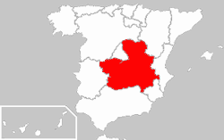
- Description : Location of Castille-La Mancha in a Spain map
- Author : Quadell

|
Ez a fájl szabadon másolható, terjeszthető és/vagy módosítható a GNU Szabad Dokumentációs Licenc feltételei alapján, az 1.2 vagy későbbi, a Free Software Foundation által publikált Nem Változtatható szakaszok, Címlapszövegek és Hátlapszövegek nélküli változat szerint. E licenc egy példánya a GNU Szabad Dokumentációs Licenc című fejezetben olvasható. |
| Ez a fájl a Creative Commons Nevezd meg! – Így add tovább! 3.0 Unported licenc alapján használható fel. | ||
| ||
| Ez a licenc a GFDL licenccsere során került a fájlra. |
Fájltörténet
Kattints egy időpontra, hogy a fájl akkori állapotát láthasd.
| Dátum/idő | Bélyegkép | Felbontás | Feltöltő | Megjegyzés | |
|---|---|---|---|---|---|
| aktuális | 2009. december 26., 01:21 | | 250 × 157 (5 KB) | Martin H. | Reverted to version as of 20:06, 8 March 2005 |
| 2009. december 25., 20:33 |  | 250 × 189 (27 KB) | Vegggggggggggggg | . | |
| 2005. március 8., 22:06 |  | 250 × 157 (5 KB) | Richie | replaced map because it contained gamma correction leading to different background colour in different browsers | |
| 2004. december 23., 21:06 |  | 250 × 157 (10 KB) | David Legrand |
Fájlhasználat
Az alábbi lap használja ezt a fájlt:
Globális fájlhasználat
A következő wikik használják ezt a fájlt:
- Használata itt: be.wikipedia.org
- Használata itt: bs.wikipedia.org
- Használata itt: de.wikipedia.org
- Használata itt: de.wiktionary.org
- Használata itt: frp.wikipedia.org
- Használata itt: fr.wikipedia.org
- Használata itt: hr.wikipedia.org
- Használata itt: hy.wikipedia.org
- Használata itt: jv.wikipedia.org
- Használata itt: ka.wikipedia.org
- Használata itt: kk.wikipedia.org
- Használata itt: kw.wikipedia.org
- Használata itt: lb.wikipedia.org
- Használata itt: mk.wikipedia.org
- Használata itt: pt.wiktionary.org
- Használata itt: xmf.wikipedia.org