
Fájl:Union County Courthouse, La Grande, Oregon.jpg

Eredeti fájl (1 280 × 960 képpont, fájlméret: 164 KB, MIME-típus: image/jpeg)
|
Ez a fájl a Wikimedia Commonsból származik. Az alább látható leírás az ottani dokumentációjának másolata. A Commons projekt szabad licencű kép- és multimédiatár. Segíts te is az építésében! |
Összefoglaló
| Leírás |
La Grande is a city in Union County, Oregon, United States.The population was 13,082 at the 2010 census. It is the county seat of Union County. La Grande lies east of the Blue Mountains and southeast of Pendleton. The Grande Ronde Valley had long been a waypoint along the Oregon Trail. The first permanent settler in the La Grande area was Benjamin Brown in 1861. La Grande was incorporated as a city in 1865, and platted in 1868. La Grande grew rapidly during the late 1860s and early 1870s, partially because of the many gold mines in the region and the valley's agricultural capabilities. The early business establishments centered on C Avenue between present day Fourth Street and the hillside on the west end. La Grande's Eastern Oregon University, formerly known as Eastern Oregon State College, began in 1929 as Eastern Oregon Normal School, a teachers college. La Grande had a factory for processing sugar beets into raw sugar. The sugar beets came from the nearby Mormon town of Nibley, Oregon, and both were owned by the Oregon Sugar Company. en.wikipedia.org/wiki/La_Grande,_Oregon en.wikipedia.org/wiki/Wikipedia:Text_of_Creative_Commons_... |
| Dátum | |
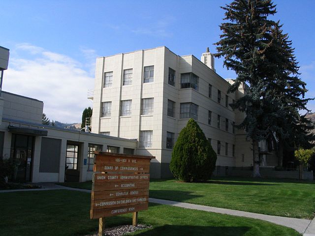
| Forrás | Union County Courthouse, La Grande, Oregon |
| Szerző | Ken Lund from Reno, Nevada, USA |
| Fényképező elhelyezkedése | | További képek erről a helyről: OpenStreetMap |
|---|
Licenc
- A következőket teheted a művel:
- megoszthatod – szabadon másolhatod, terjesztheted, bemutathatod és előadhatod a művet
- feldolgozhatod – származékos műveket hozhatsz létre
- Az alábbi feltételekkel:
- Nevezd meg! – A szerzőt megfelelően fel kell tüntetned, hivatkozást kell létrehoznod a licencre és jelezned kell, ha a művön változtatást hajtottál végre. Ezt bármilyen észszerű módon megteheted, kivéve oly módon, ami azt sugallná hogy a jogosult támogat téged vagy a felhasználásod körülményeit.
- Így add tovább! – Ha megváltoztatod, átalakítod, feldolgozod ezt a művet, a közreműködésedet csak az eredetivel megegyező vagy hasonló licenc alatt terjesztheted.
| This image was originally posted to Flickr by Ken Lund at https://flickr.com/photos/75683070@N00/265581433. It was reviewed on 2016. január 23. by FlickreviewR and was confirmed to be licensed under the terms of the cc-by-sa-2.0. |
Fájltörténet
Kattints egy időpontra, hogy a fájl akkori állapotát láthasd.
| Dátum/idő | Bélyegkép | Felbontás | Feltöltő | Megjegyzés | |
|---|---|---|---|---|---|
| aktuális | 2016. január 23., 06:23 | | 1 280 × 960 (164 KB) | Kingofthedead | Transferred from Flickr via Flickr2Commons |
Fájlhasználat
Az alábbi lap használja ezt a fájlt:
Globális fájlhasználat
A következő wikik használják ezt a fájlt:
- Használata itt: ar.wikipedia.org
- Használata itt: ceb.wikipedia.org
- Használata itt: ce.wikipedia.org
- Használata itt: cy.wikipedia.org
- Használata itt: eo.wikipedia.org
- Használata itt: es.wikipedia.org
- Használata itt: fr.wikipedia.org
- Használata itt: hy.wikipedia.org
- Használata itt: it.wikipedia.org
- Használata itt: ko.wikipedia.org
- Használata itt: no.wikipedia.org
- Használata itt: pl.wikipedia.org
- Használata itt: ru.wikipedia.org
- Használata itt: sr.wikipedia.org
- Használata itt: tr.wikipedia.org
- Használata itt: tt.wikipedia.org
- Használata itt: ur.wikipedia.org
- Használata itt: www.wikidata.org