
Fájl:USACE Black Butte Dam and Lake.jpg

Az előnézet mérete: 800 × 526 képpont További felbontások: 320 × 211 képpont | 640 × 421 képpont | 1 024 × 674 képpont | 1 500 × 987 képpont.
Eredeti fájl (1 500 × 987 képpont, fájlméret: 619 KB, MIME-típus: image/jpeg)
|
Ez a fájl a Wikimedia Commonsból származik. Az alább látható leírás az ottani dokumentációjának másolata. A Commons projekt szabad licencű kép- és multimédiatár. Segíts te is az építésében! |
| Leírás |
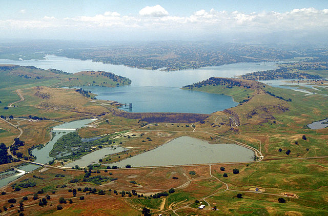
English: Aerial view of Black Butte Dam and Lake in Tehama County, California, USA. The dam was constructed in 1963 for flood control on Stony Creek. The dam is located approximately 9 miles (14.5 km) west of Orland, California.
Coordinates: 39°49′1.17″N 122°20′14.13″W / 39.8169917°N 122.3372583°W |
|||
| Helyszín | Tehama and Glenn Counties, California, USA | |||
| Dátum | not specified or unknown | |||
| Forrás |
U.S. Army Corps of Engineers Digital Visual Library Image page Image description page Digital Visual Library home page |
|||
| Szerző | Michael Nevins, U.S. Army Corps of Engineers | |||
| Engedély (Fájl újrafelhasználása) |
|
Fájltörténet
Kattints egy időpontra, hogy a fájl akkori állapotát láthasd.
| Dátum/idő | Bélyegkép | Felbontás | Feltöltő | Megjegyzés | |
|---|---|---|---|---|---|
| aktuális | 2007. május 5., 07:47 | | 1 500 × 987 (619 KB) | DanMS | {{Information | Description = {{en|Aerial view of Black Butte Dam and Lake in Tehama County, California, USA. The dam was constructed in 1963 for flood control on Stony Creek. The dam is located approximately 9 miles (15.4 km) west of Orland, Californi |
Fájlhasználat
Az alábbi lapok használják ezt a fájlt:
Globális fájlhasználat
A következő wikik használják ezt a fájlt:
- Használata itt: ar.wikipedia.org
- Használata itt: arz.wikipedia.org
- Használata itt: az.wikipedia.org
- Használata itt: be.wikipedia.org
- Használata itt: ceb.wikipedia.org
- Használata itt: ce.wikipedia.org
- Használata itt: cs.wikipedia.org
- Használata itt: cy.wikipedia.org
- Használata itt: de.wikipedia.org
- Használata itt: en.wikipedia.org
- Használata itt: en.wikivoyage.org
- Használata itt: es.wikipedia.org
- Használata itt: ga.wikipedia.org
- Használata itt: hy.wikipedia.org
- Használata itt: no.wikipedia.org
- Használata itt: pl.wikipedia.org
- Használata itt: pt.wikipedia.org
- Használata itt: ru.wikipedia.org
- Használata itt: sr.wikipedia.org
- Használata itt: tr.wikipedia.org
- Használata itt: tt.wikipedia.org
- Használata itt: vi.wikipedia.org
- Használata itt: www.wikidata.org